As a student of Geographic Information Systems (GIS), I am learning to integrate imagery and software to reveal truths about the world. I am a novice, but enjoying the journey.
________________________________________________________________________________________
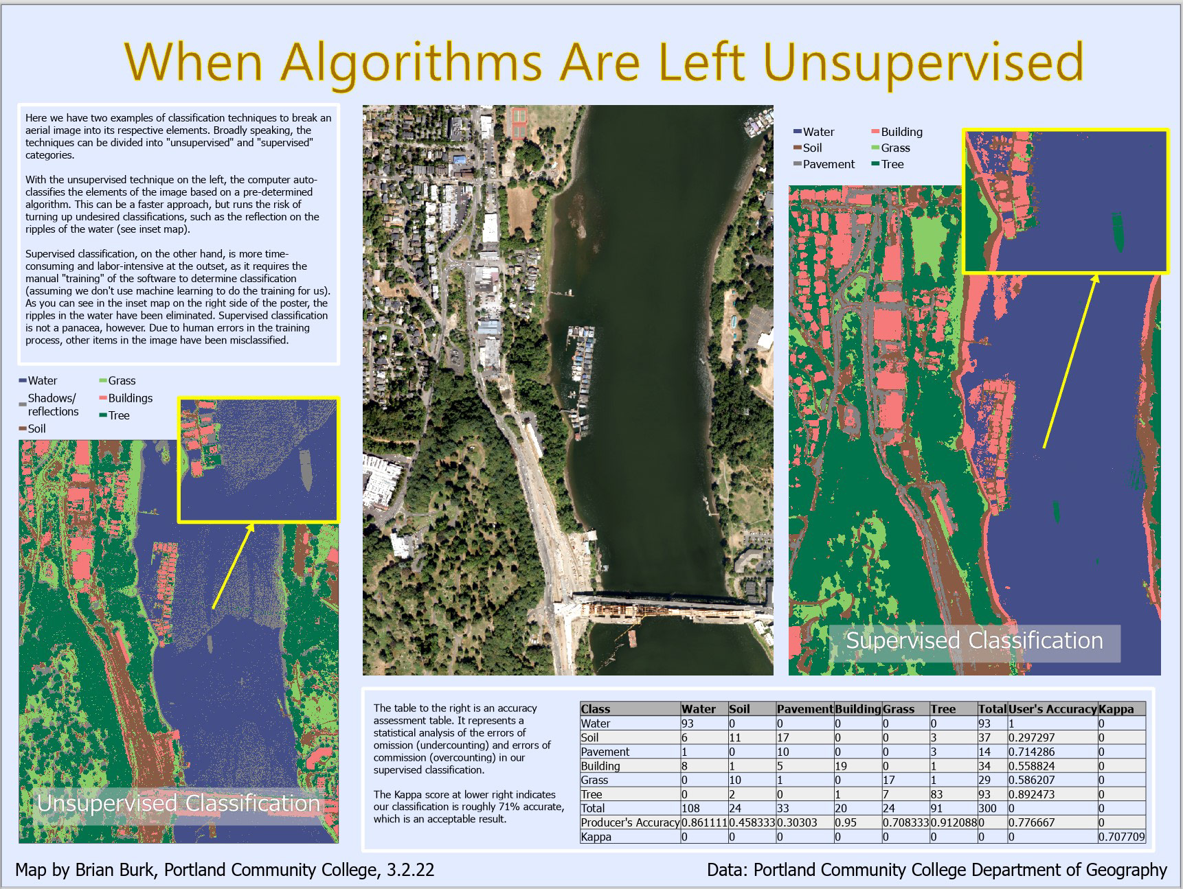
This presentation demonstrates the use of two different techniques to classify elements of an aerial image. One technique is performed by software alone, and known as "unsupervised" classification (left). The other technique, "supervised" classification (right), is done manually. It is more accurate, but takes more time.
________________________________________________________________________________________
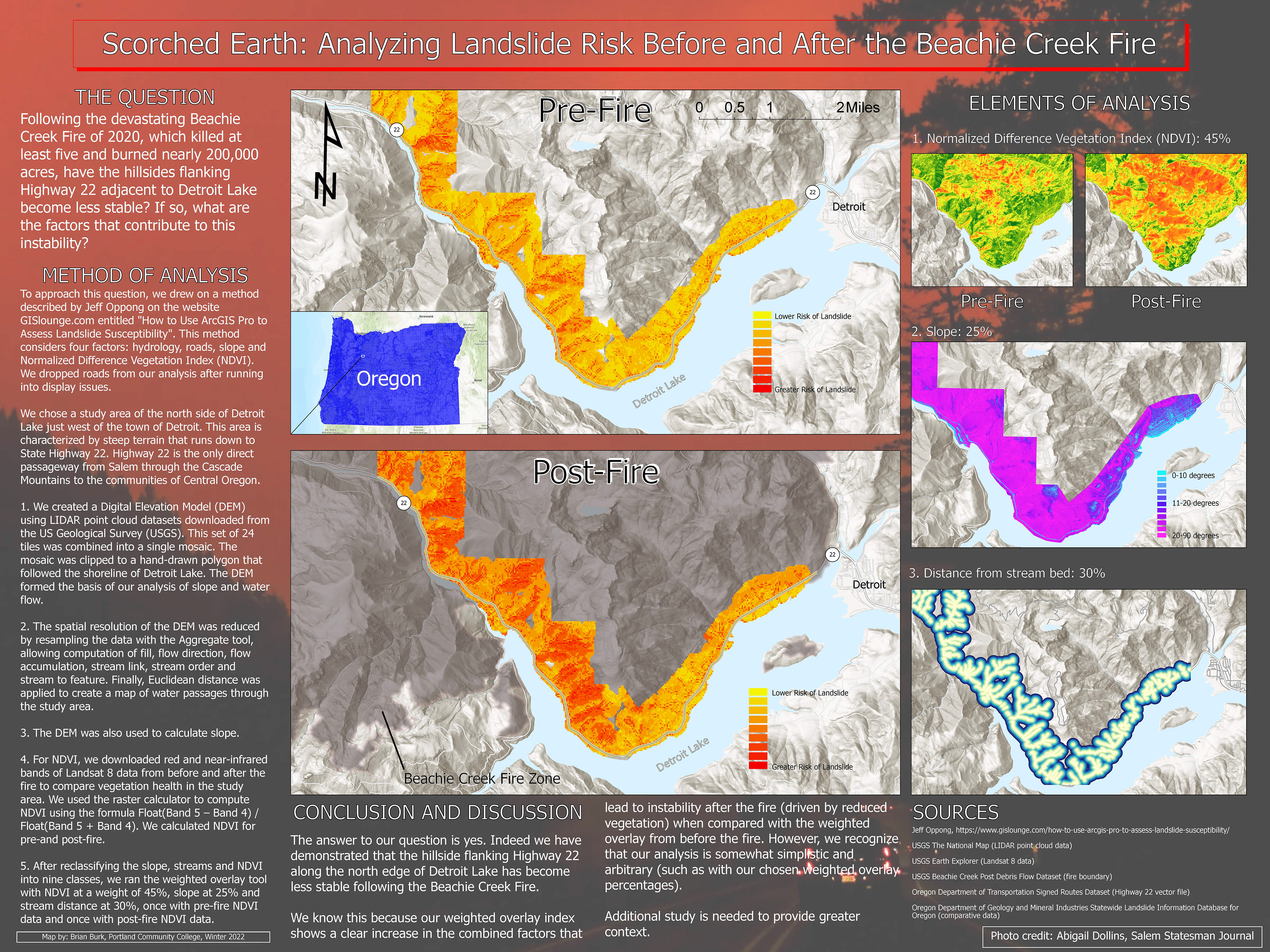
This map shows the increased risk of landslides that results from wildfire, because of the loss of root systems that hold back soil on steep sloped terrain. After first using LIDAR point cloud datasets to create a Digital Elevation Model (DEM), then created a Normalized Difference Vegetation Index to compare the pre-fire and post-fire level of vegetation. Finally, using the weighted overlay tool, we created a landslide risk graphic based on slope, vegetation and other factors, and compared the pre-fire and post-fire landslide risks.
________________________________________________________________________________________
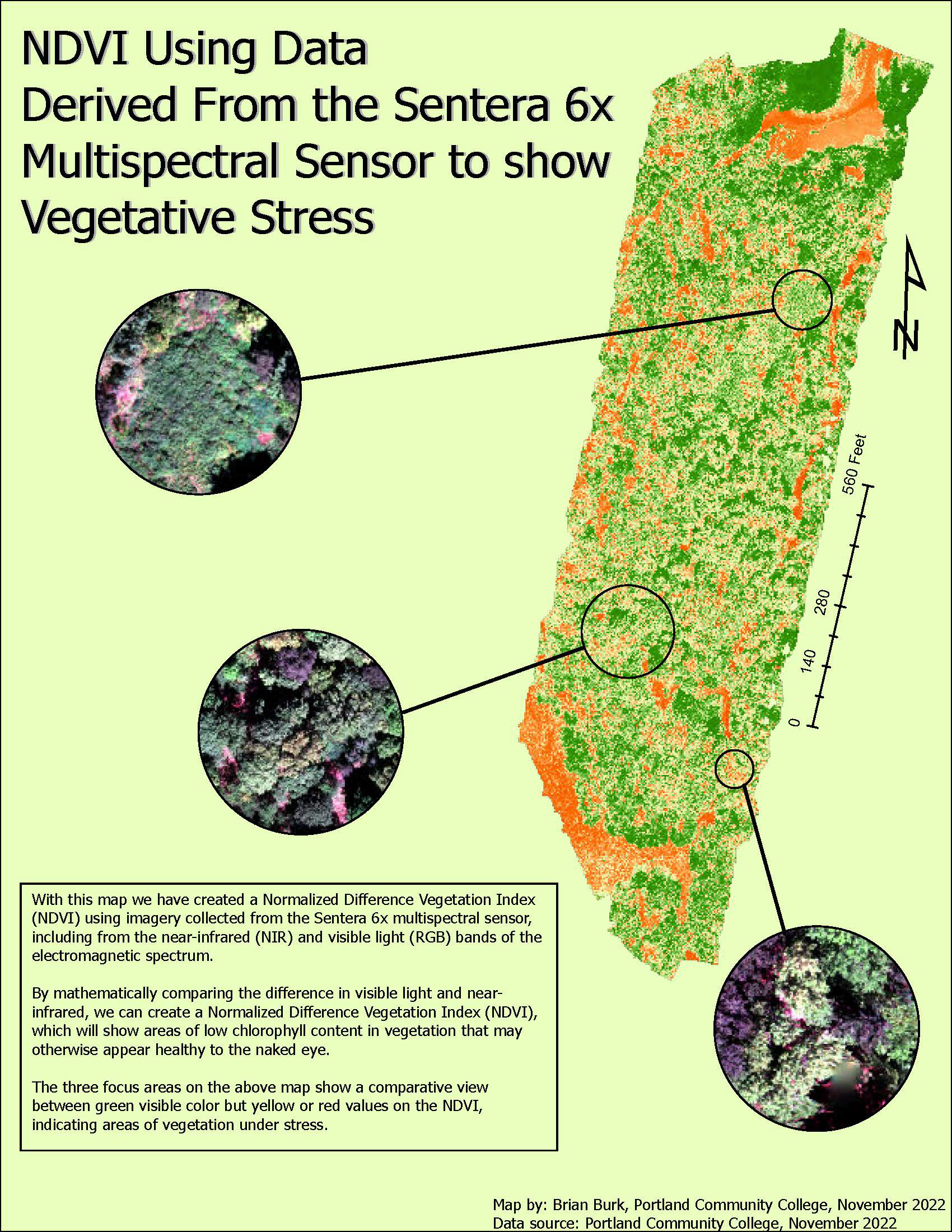
This map also uses a Normalized Difference Vegetation Index to demonstrate areas of healthy versus unhealthy vegetation that may otherwise appear healthy to the naked eye (i.e. both healthy and unhealthy vegetation can appear green).
________________________________________________________________________________________
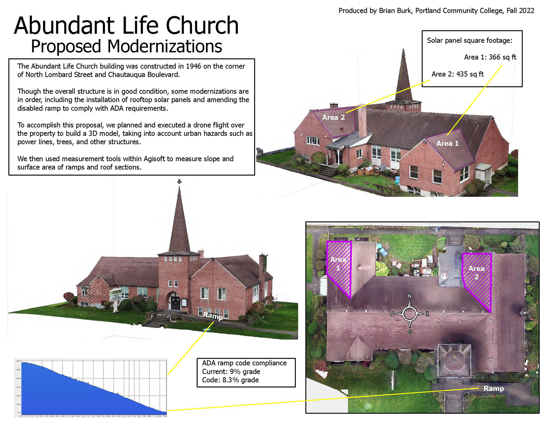
This presentation took drone-derived photogrammetry data to create a 3D model of a church, and then used measurement tools within the software to measure area and slope to propose modernizations to the property, such as rooftop solar panels and an improved accessibility ramp. For an interesting photo taken in the parking lot of this church, click here.
________________________________________________________________________________________
________________________________________________________________________________________
________________________________________________________________________________________
________________________________________________________________________________________